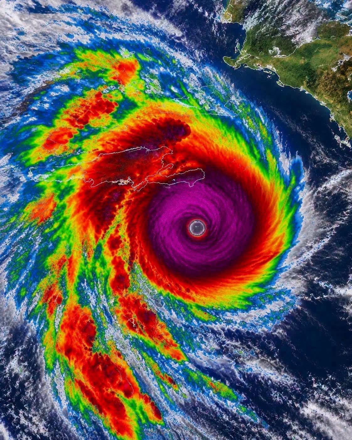
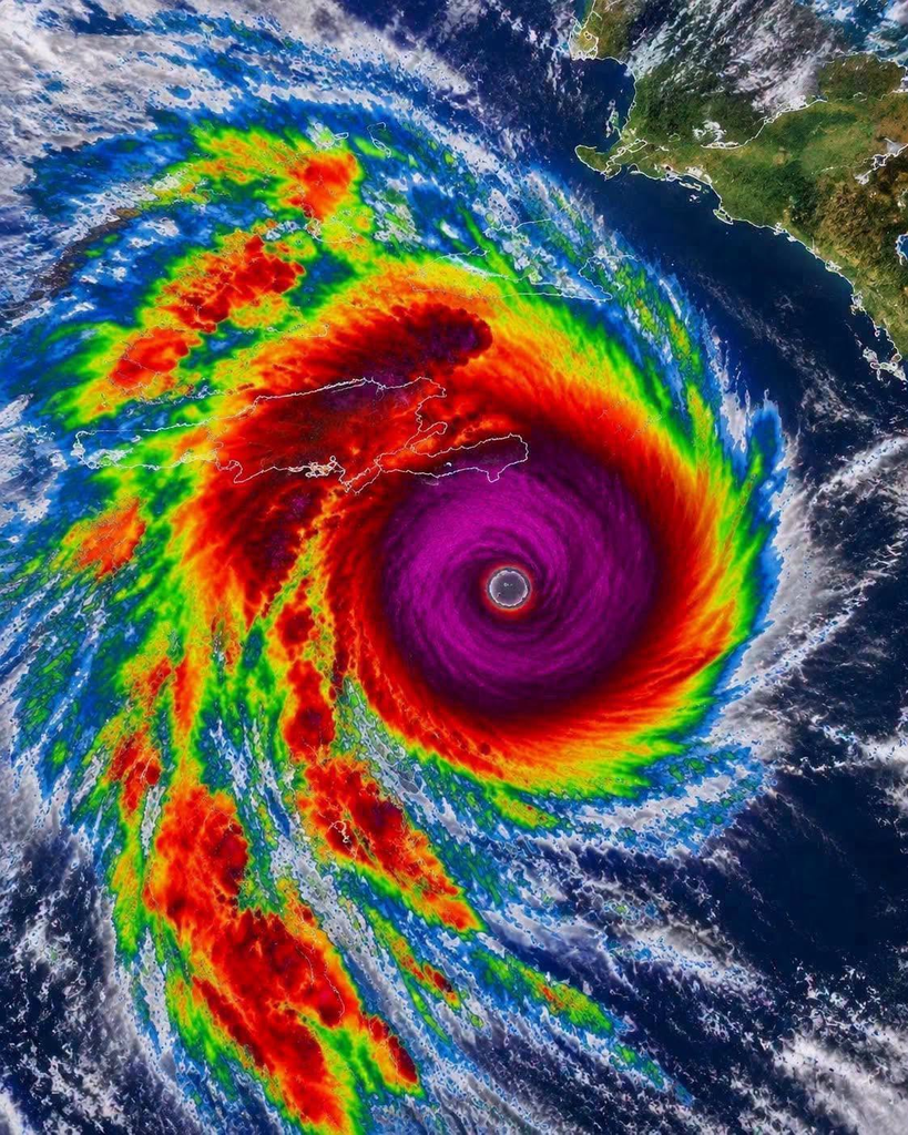
Hurricane Melissa became one of the most powerful Atlantic hurricanes on record during the 2025 hurricane season. The storm reached Category 5 intensity and caused catastrophic damage, particularly in Jamaica, where destructive winds, storm surge, and heavy rainfall created dangerous conditions.
Although dramatic satellite images of Melissa continue to circulate online, it is important to distinguish historical footage from current weather updates. The photograph alone does not establish that a hurricane is currently forming or strengthening.
Did Hurricane Melissa Reach Category 5 Strength?
Yes. According to the U.S. National Hurricane Center, Hurricane Melissa reached Category 5 intensity in October 2025, with maximum sustained winds reaching approximately 165 mph (270 km/h) and a minimum central pressure of 892 millibars. It was one of the strongest hurricanes recorded in the Atlantic basin. <Cite refs={[“turn118090search16″,”turn118090search11”]}/>
Category 5 is the highest classification on the Saffir-Simpson Hurricane Wind Scale. It is used for hurricanes with maximum sustained winds of at least 157 mph (252 km/h).
Storms of this intensity can cause catastrophic structural damage, widespread power outages, and dangerous conditions for people in affected areas.
Why Was Hurricane Melissa So Powerful?
Several atmospheric and oceanic conditions contributed to Melissa’s exceptional strength.
Warm Ocean Waters
Hurricanes draw energy from warm ocean water. When conditions are favorable, heat and moisture from the ocean help thunderstorms develop and sustain the storm’s circulation.
Favorable Atmospheric Conditions
Low vertical wind shear can help a hurricane maintain its structure. Wind shear refers to changes in wind speed or direction with height, which can disrupt a storm’s organization when sufficiently strong.
Slow Movement
Melissa’s slow movement contributed to prolonged periods of heavy rainfall in parts of the Caribbean. When a powerful tropical cyclone moves slowly over or near land, rainfall can accumulate over the same areas, increasing the risk of flooding and landslides.
These factors can interact in complex ways, which is why hurricane intensity and movement are closely monitored by meteorologists.
What Does Category 5 Mean?
The Saffir-Simpson Hurricane Wind Scale classifies hurricanes according to their maximum sustained wind speeds.
- Category 1: 74–95 mph
- Category 2: 96–110 mph
- Category 3: 111–129 mph
- Category 4: 130–156 mph
- Category 5: 157 mph or higher
Categories 3, 4, and 5 are classified as major hurricanes.
The scale measures wind intensity, not the full range of hazards a storm can produce. Rainfall flooding, storm surge, and dangerous waves can cause severe impacts even outside the areas experiencing the strongest winds.
What Areas Were Affected by Hurricane Melissa?
Jamaica experienced catastrophic impacts when Melissa made landfall as a Category 5 hurricane on October 28, 2025. The storm also affected other parts of the Caribbean, including Cuba and the Bahamas, as it continued along its path. <Cite refs={[“turn118090search16″,”turn118090news10”]}/>
The combination of destructive winds, coastal flooding, heavy rainfall, and landslides created serious challenges for affected communities.
Recovery after a major hurricane can take considerable time. Damage to homes, roads, electricity networks, water systems, and other infrastructure may continue to affect residents long after the storm has passed.
How Can People Prepare for a Major Hurricane?
Although every storm follows a different path, several precautions can help people prepare for severe tropical weather.
Follow official forecasts. Check updates from the relevant national meteorological service and local emergency authorities.
Prepare essential supplies. Keep drinking water, nonperishable food, necessary medications, flashlights, batteries, and a first-aid kit available.
Secure important documents. Store identification, insurance information, and other essential records in a protected location.
Plan for evacuation if necessary. Know the local evacuation routes and follow official instructions promptly.
Avoid floodwater. Flooded roads can conceal dangerous currents, debris, and damaged surfaces. Never attempt to drive or walk through floodwater.
Stay informed during recovery. Follow local guidance about damaged buildings, electrical hazards, drinking water, and returning to affected areas.
Preparation is especially important for people living in coastal communities and locations vulnerable to flooding or landslides.
Is Hurricane Melissa Forming Again in 2026?
The image circulating with claims that Melissa is currently forming can be misleading if presented without a date or context.
The National Hurricane Center’s historical records identify Melissa as a storm from October 21–31, 2025. Its official 2026 Atlantic season records are separate from that historical event. <Cite refs={[“turn118090search16″,”turn118090search12”]}/>
Hurricane photographs and satellite images are frequently shared again after major weather events. Before treating a post as breaking news, check its publication date and compare the claim with current official forecasts.
For current tropical weather information, consult the National Hurricane Center at https://www.nhc.noaa.gov/.
Final Thoughts
Hurricane Melissa demonstrated how destructive a powerful tropical cyclone can become when intense winds, coastal hazards, and heavy rainfall affect populated areas.
Its history also highlights the importance of reliable weather information and preparation before severe storms arrive. While striking satellite images can help illustrate a hurricane’s structure, they should always be accompanied by accurate dates and verified information.
Understanding the difference between historical storm footage and current forecasts helps readers stay informed without spreading outdated or misleading weather reports.